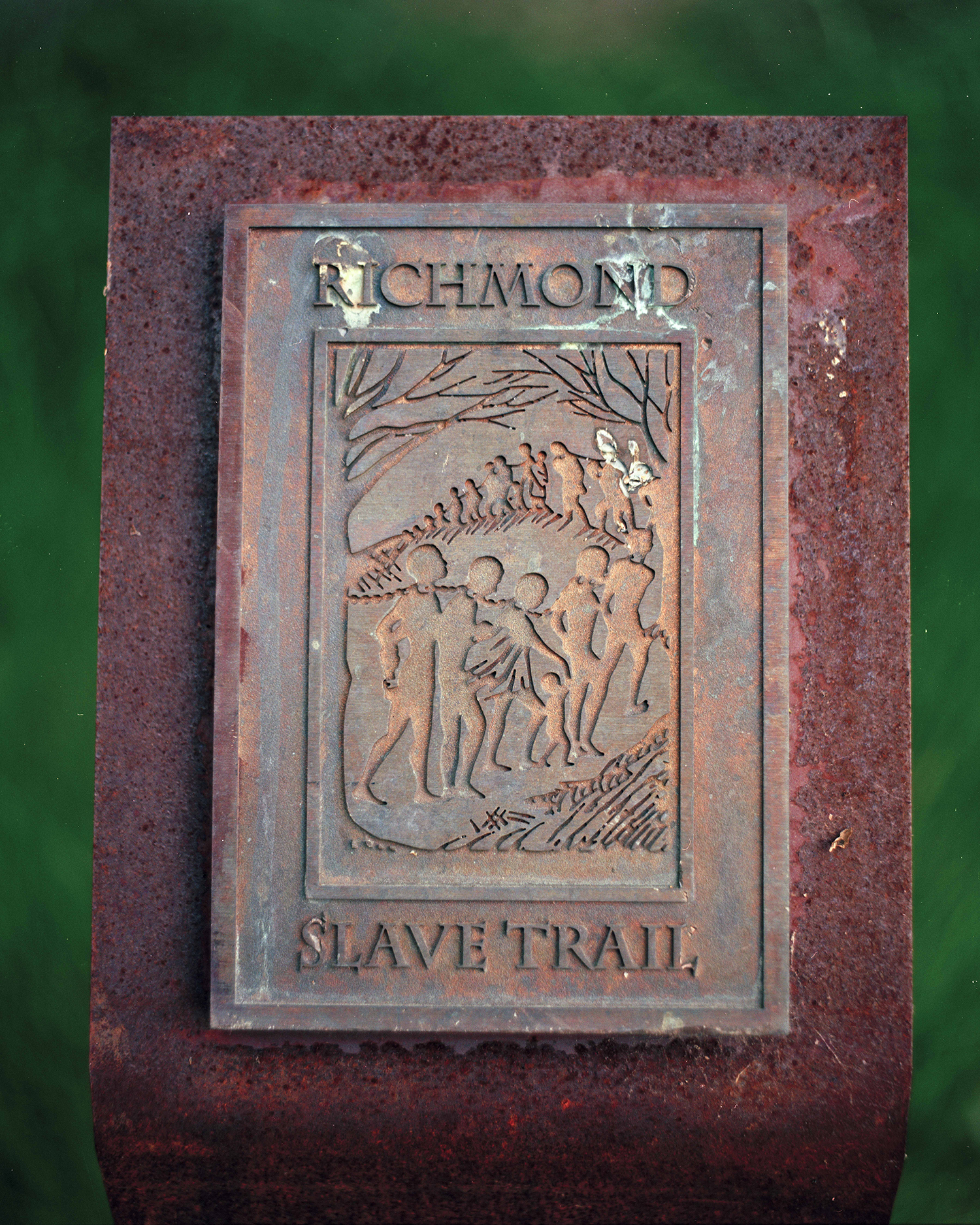
Richmond Slave Trail Marker — Richmond, Virginia The bronze trail marker that identifies the Richmond Slave Trail, a 2.5-mile pedestrian route designated in 1998 by the Richmond Slave Trail Commission. The trail commemorates the city's role in both the trans-Atlantic and domestic slave trades, with 17 interpretive stations unveiled in 2011 along the path from the Manchester Docks to the Shockoe Bottom auction district.
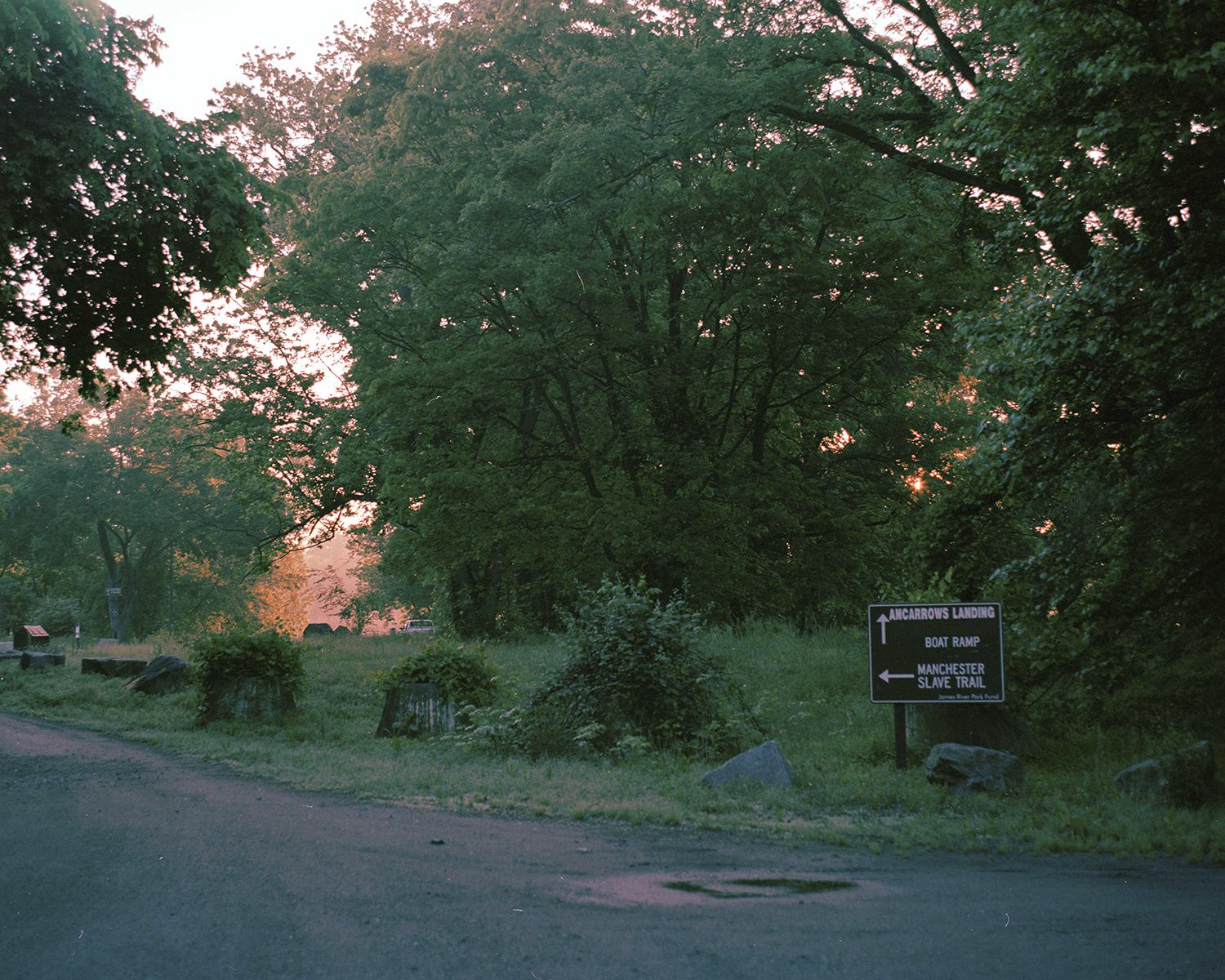
Manchester Slave Trail — Ancarrow's Landing, James River Park System, Richmond, Virginia The southern trailhead of the Richmond Slave Trail at Ancarrow's Landing, where the path enters the wooded riverbank above the former Manchester Docks. Enslaved Africans were marched in chains from the docks up this route at night, away from the view of citizens, on their way to the Shockoe Bottom slave pens.
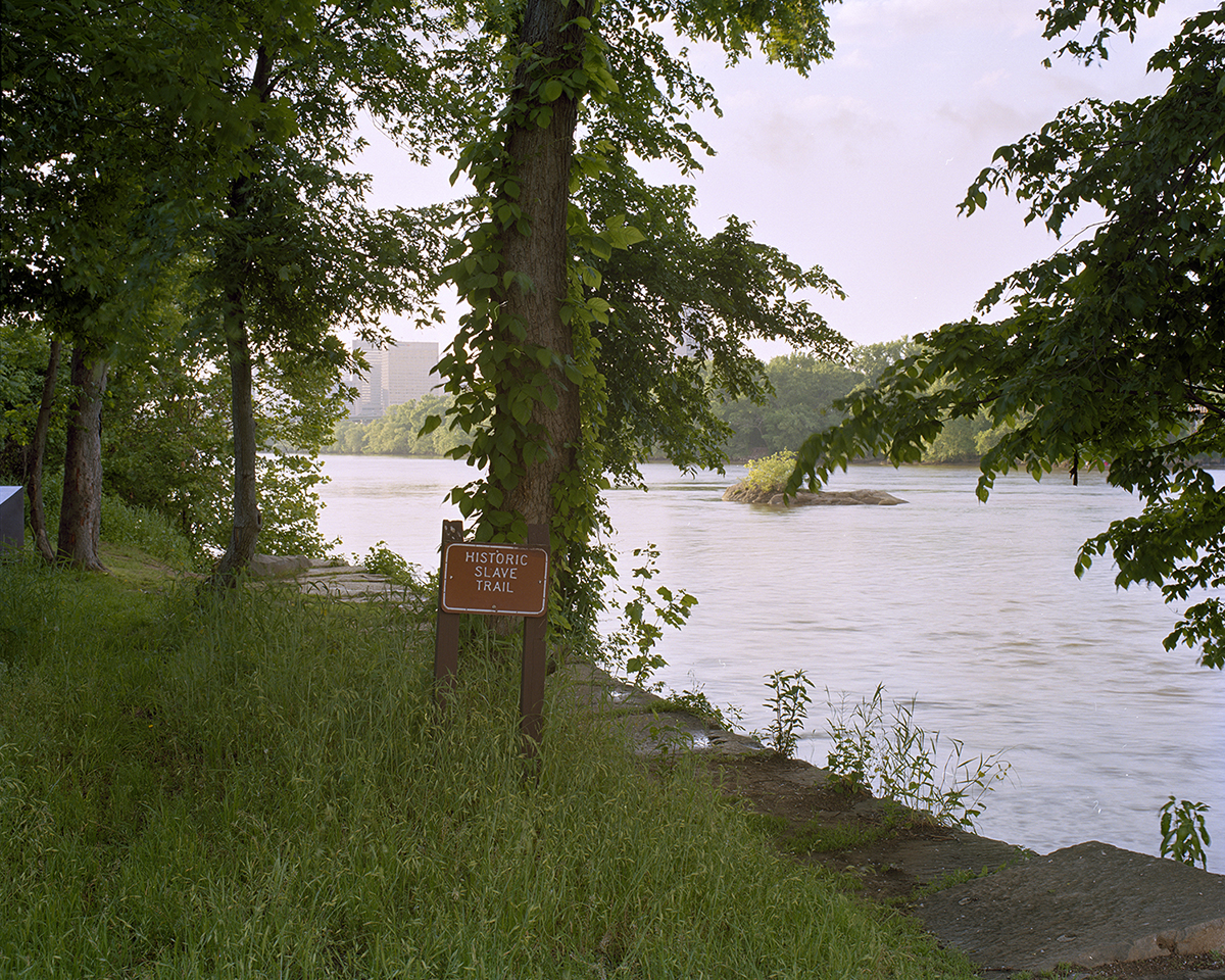
Manchester Docks at Ancarrow's Landing — South bank of the James River, Richmond, Virginia The site of the former Manchester Docks, a major port in the domestic slave trade that made Richmond the largest source of enslaved Africans on the East Coast from 1830 to 1860. From the 1820s through the Civil War, enslaved people purchased in Virginia were marched back down this path to the docks and shipped south to the cotton and sugar plantations of the Deep South.
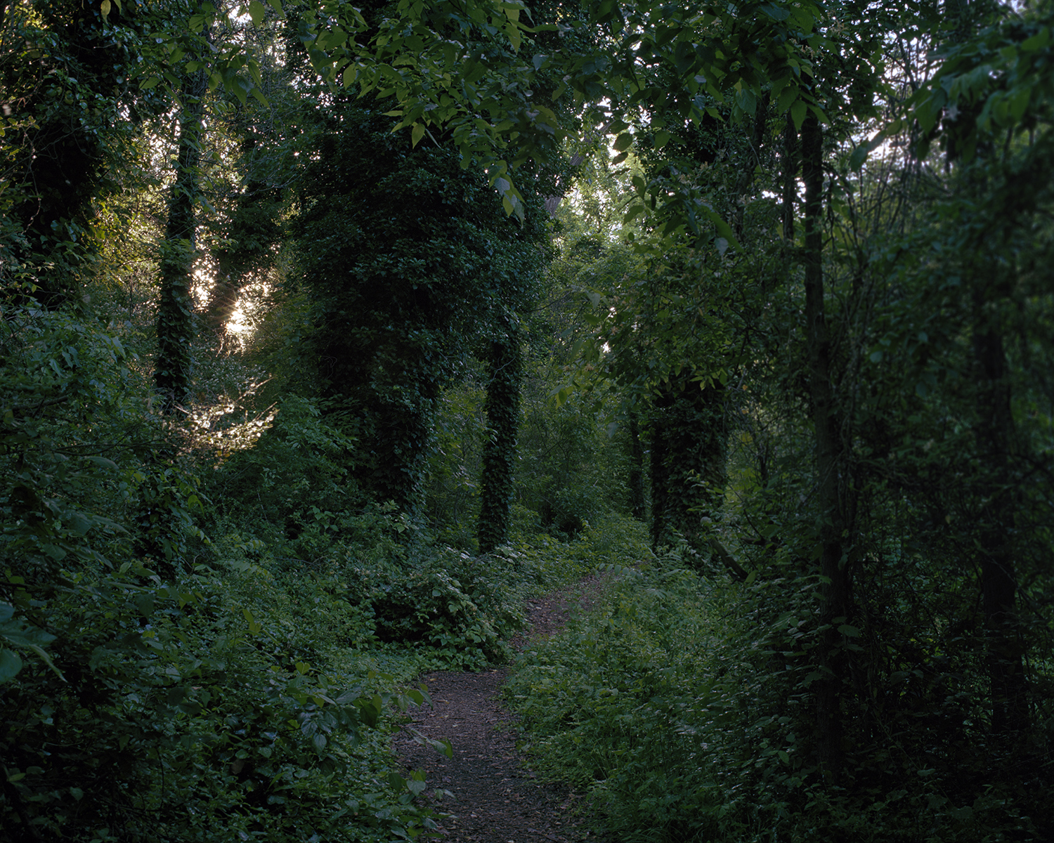
Slave Trail Wooded Path — James River bank, Richmond, Virginia The wooded section of the trail that follows the south bank of the James River between Ancarrow's Landing and the Mayo Bridge. The earliest stations along this stretch, Crossing the Atlantic, Mechanics of Slavery, and Despair of Slavery, mark the physical route enslaved people were forced to walk in chains.
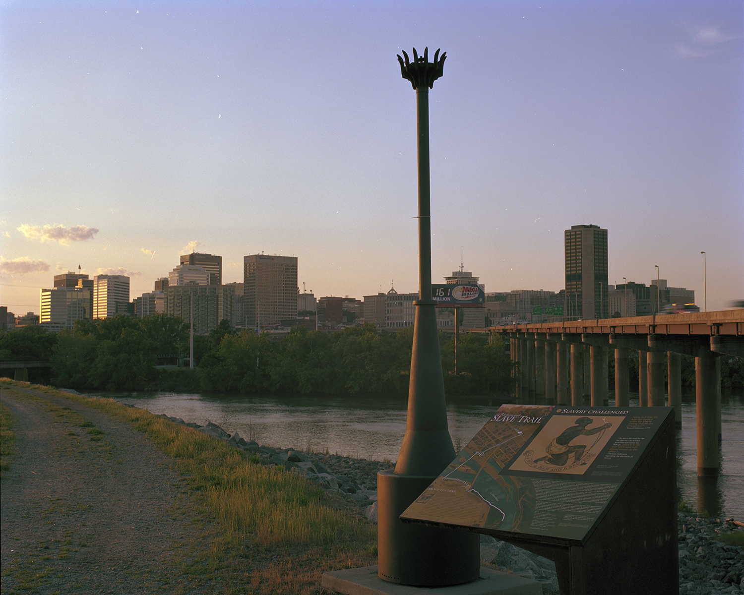
Slavery Challenged Marker — Brander Street access road, Richmond, Virginia An interpretive station on the Richmond Slave Trail marking the sixth stop, Slavery Challenged, set near the top of the access road from Ancarrow's Landing with the downtown Richmond skyline across the James River. The station situates Richmond's slave trade against the rising abolitionist resistance of the antebellum period.
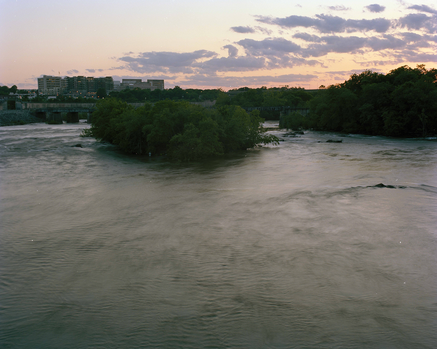
James River Crossing — James River at Mayo Bridge, Richmond, Virginia The James River crossing along the slave trail, where the path transitions from the wooded southern bank to the paved Canal Walk on the north side. Enslaved Africans arrived up this river from the Atlantic until 1778, and from the 1820s onward were shipped back down it to slave markets in New Orleans and beyond.
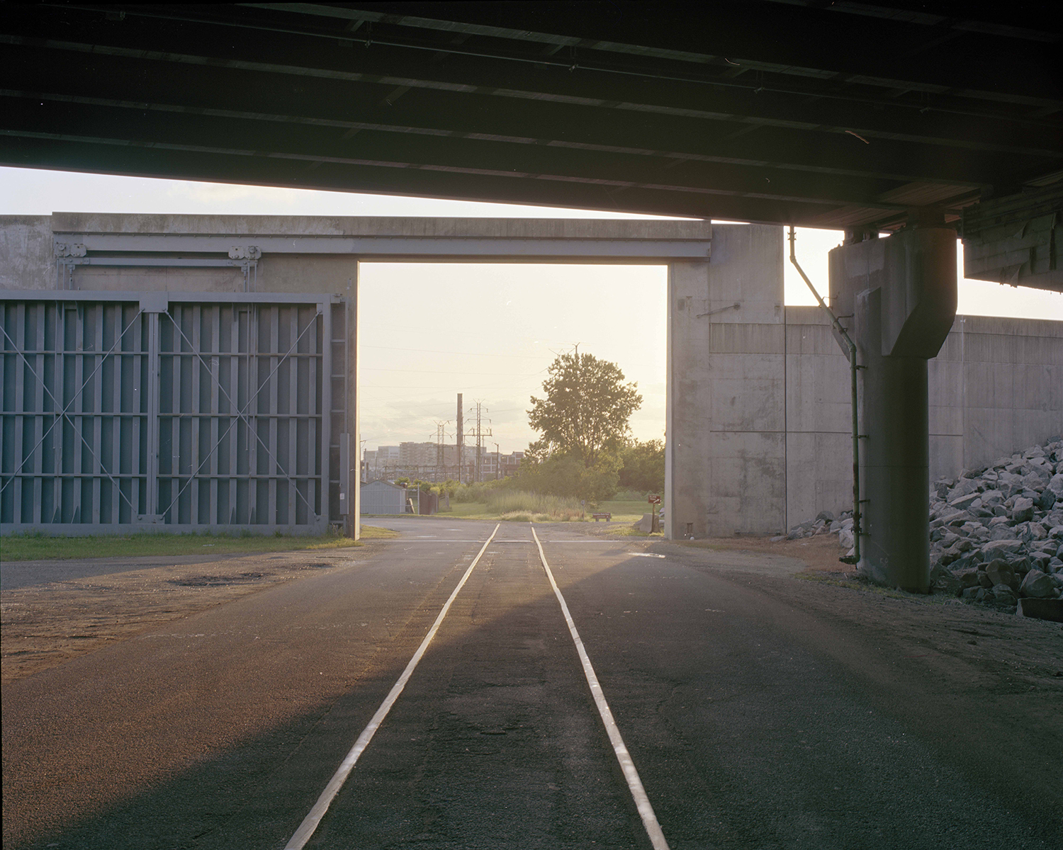
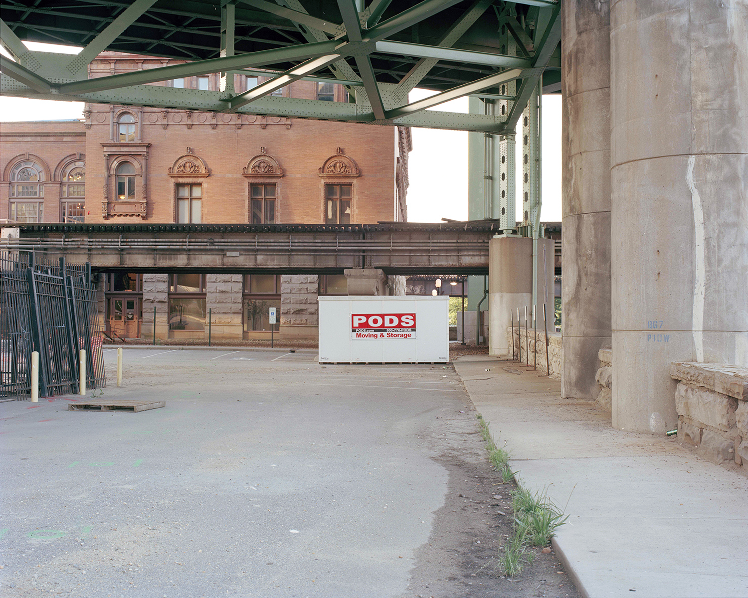
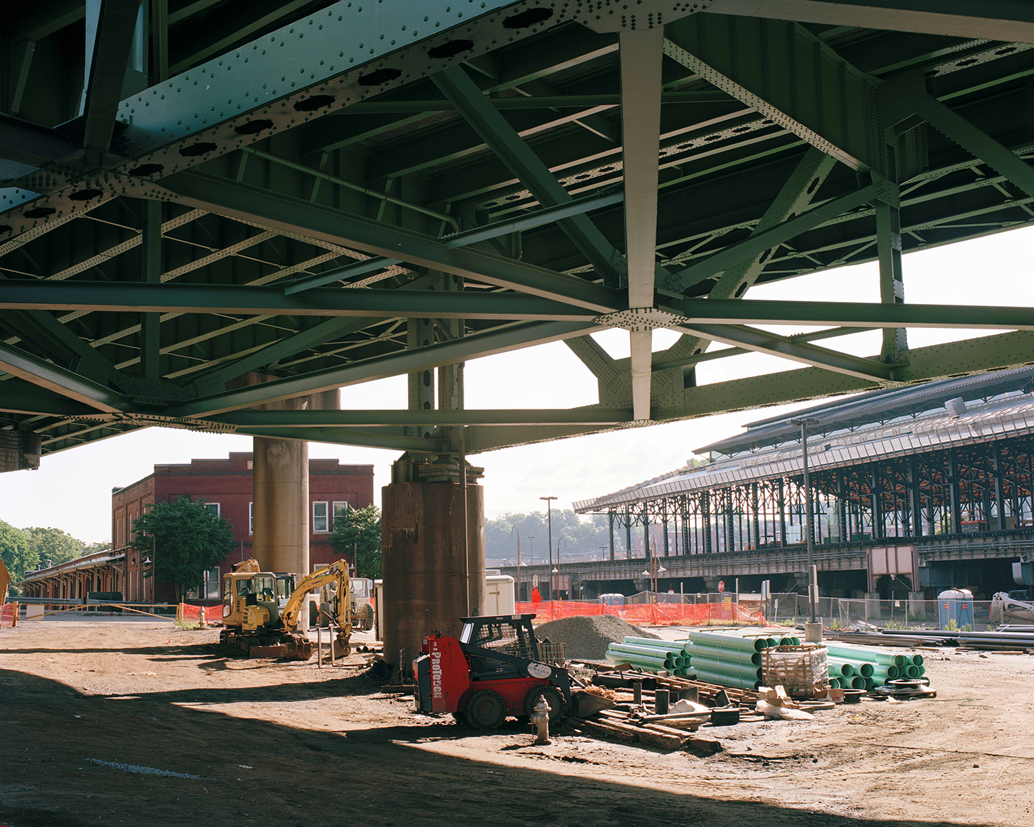
Trail Underpass — Beneath I-95, Richmond, Virginia A section of the trail beneath Interstate 95 near the Manchester Docks. Construction of the interstate in the mid-twentieth century leveled much of the historic slave trading district in Shockoe Bottom, and the trail now passes literally under the highway that erased its physical remains.
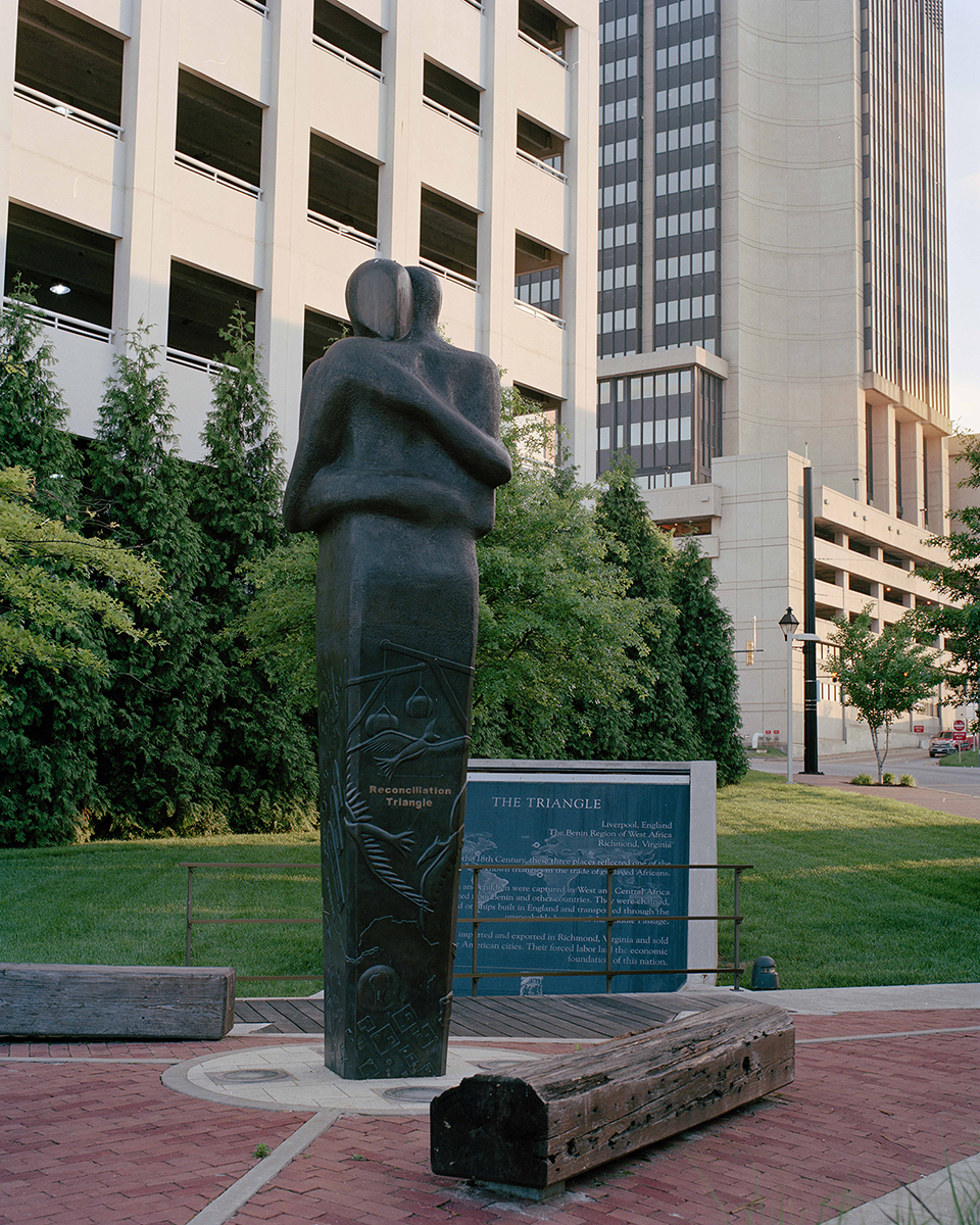
Reconciliation Triangle — 15th and East Main Streets, Shockoe Slip, Richmond, Virginia A bronze statue of two embracing figures unveiled in 2007, one of three identical sculptures by Liverpool artist Stephen Broadbent installed in Richmond, Liverpool, and Benin to mark the three points of the trans-Atlantic slave trade triangle. The Richmond statue followed apologies from the city of Liverpool and the Republic of Benin for their roles in the trade, and a 2007 Virginia General Assembly resolution expressing profound regret for slavery in the Commonwealth.
Odd Fellows Hall — Franklin and Mayo Streets, Shockoe Slip, Richmond, Virginia The site of the Odd Fellows Hall, which stood at the northeast corner of Franklin and Mayo Streets from 1841 to 1936 and hosted operas, dance ensembles, and a visit by General Tom Thumb. In the basement, slave auctions were held throughout the 1840s and 1850s, one of more than fifty such facilities concentrated in the surrounding thirty-block Shockoe Bottom trading district.
Lumpkin's Slave Jail — Shockoe Bottom, Richmond, Virginia The site of Lumpkin's Slave Jail, the largest and most infamous of Richmond's slave holding facilities, known to those imprisoned there as the Devil's Half-Acre. After the Civil War, Mary Lumpkin, a Black woman who had been enslaved by jail owner Robert Lumpkin and later became his widow, rented the complex to a Baptist minister who founded the school that became Virginia Union University.
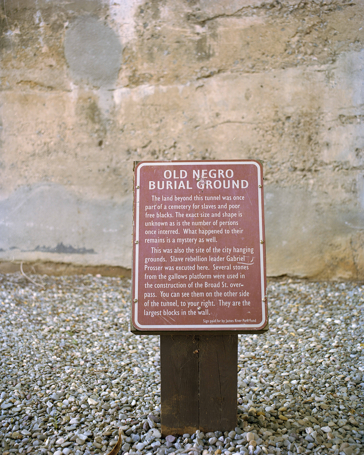
African Burial Ground — Shockoe Bottom, Richmond, Virginia The site once known as the Burial Ground for Negroes, a cemetery for enslaved people and poor free Blacks established by 1750 and used as the city's primary Black burial ground until 1816. The ground also served as Richmond's gallows, where Gabriel Prosser, leader of the 1800 slave rebellion, was hanged in October 1800.
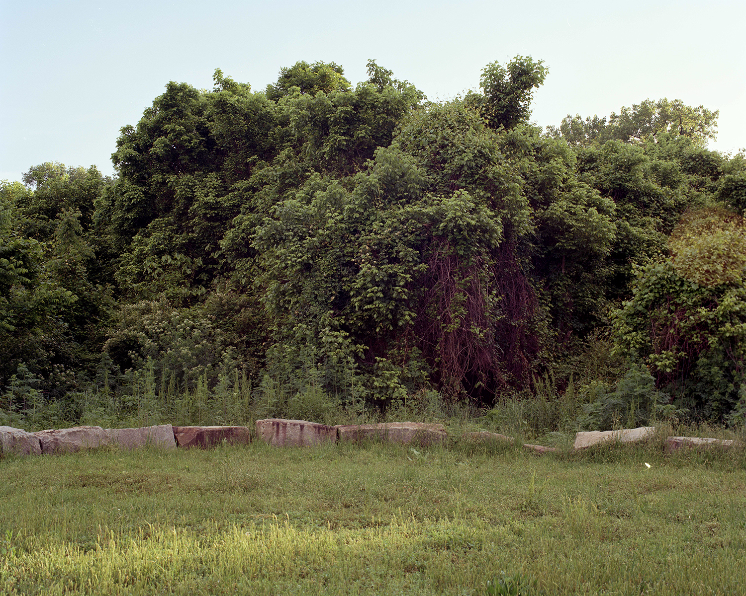
Slave Trail Marker Stones — African Burial Ground, Richmond, Virginia Granite block markers laid at the edge of the African Burial Ground site, where archaeological investigation has worked to recover the footprint of a cemetery whose exact size, shape, and number of interred remain unknown. Stones from the original gallows platform are reported to have been incorporated into the adjacent Broad Street overpass.
1/12